Two itineraries today - one that of HALO, which flew from the Cape Verde Islands to Manaus, the other my own on a commercial flight from Rio de Janeiro to Manaus.
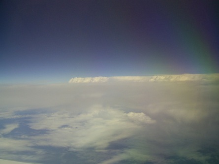
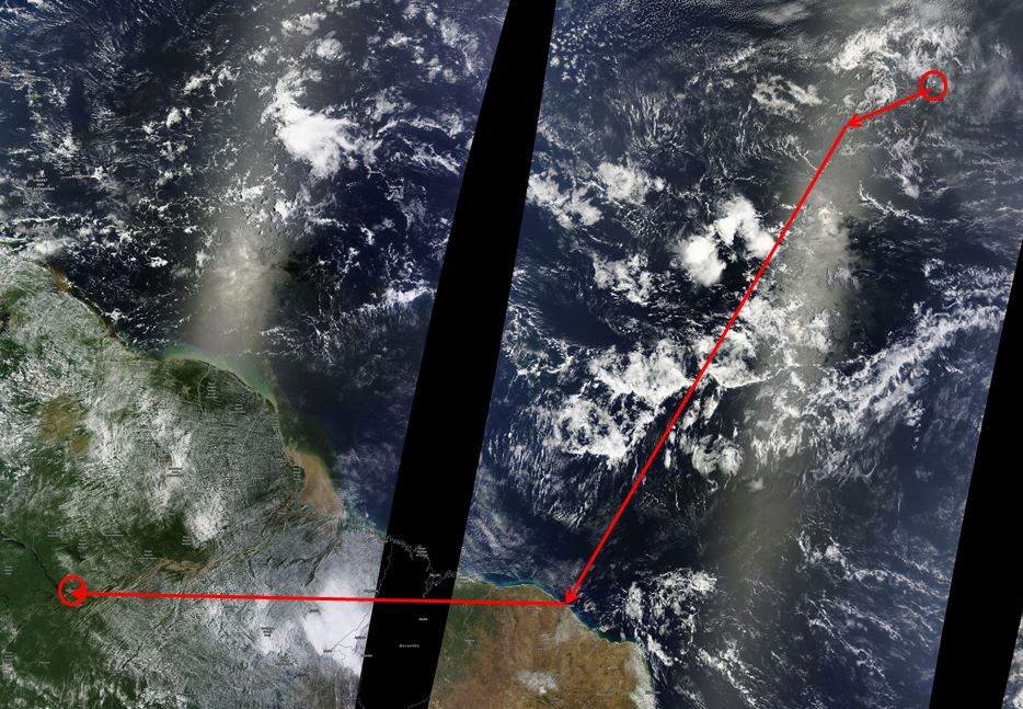
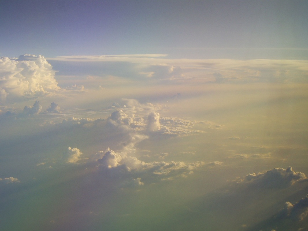
HALO left Sal Airport in the cape Verde Islands at about 1500Z and first did two short sampling legs in the Sahara dust layer at 6000 and 11000 feet. Climbing up to flight altitude after these legs showed that the highest dust concentrations today were at levels above 11000', a bit higher than the day before. Then came the long crossing over the tropical Atlantic, which took HALO through the inter-tropical convergence zone (ITCZ) with some big convective systems, which show up as white blobs over the Atlantic on the satellite image below. Elevated aerosol concentrations were observed above some of these large convective clouds and cirrus outflow anvils. An example is on the picture to the right.
HALO left Sal Airport in the cape Verde Islands at about 1500Z and first did two short sampling legs in the Sahara dust layer at 6000 and 11000 feet. Climbing up to flight altitude after these legs showed that the highest dust concentrations today were at levels above 11000', a bit higher than the day before. Then came the long crossing over the tropical Atlantic, which took HALO through the inter-tropical convergence zone (ITCZ) with some big convective systems, which show up as white blobs over the Atlantic on the satellite image below. Elevated aerosol concentrations were observed above some of these large convective clouds and cirrus outflow anvils. An example is on the picture to the right.
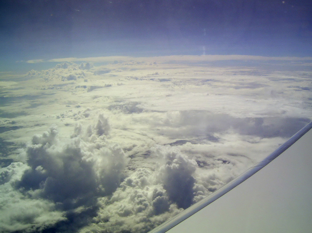
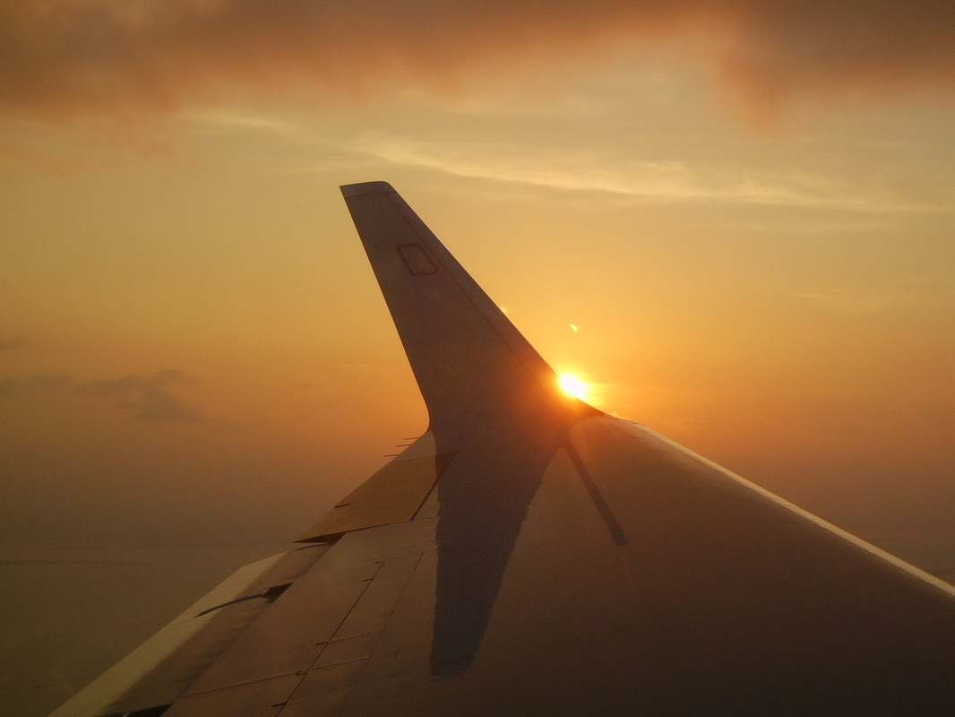
HALO reached the Brazilian coast at Fortaleza and then turned west to head for Manaus. Unfortunately, for legal reasons, we had to turn off our instruments an hour before reaching the continent, and could not get data during this part of the flight. Nevertheless, there are some beautiful pictures from this part of the flight. The images below show convective clouds growing out of a sometimes quite clean (first picture), sometimes smoke-polluted boundary layer over equatorial Brazil. Above Brazil HALO climbed up to test its ceiling altitude with its heave load of instruments, and reached an impressive 47,000 feet.
 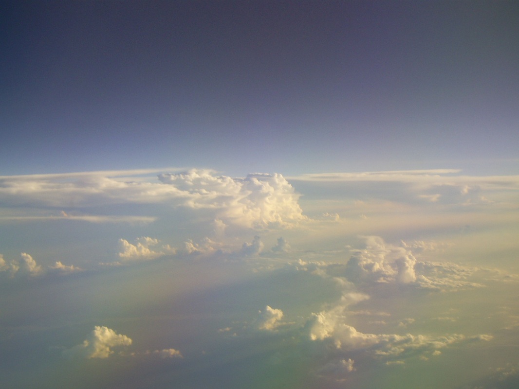 |   |
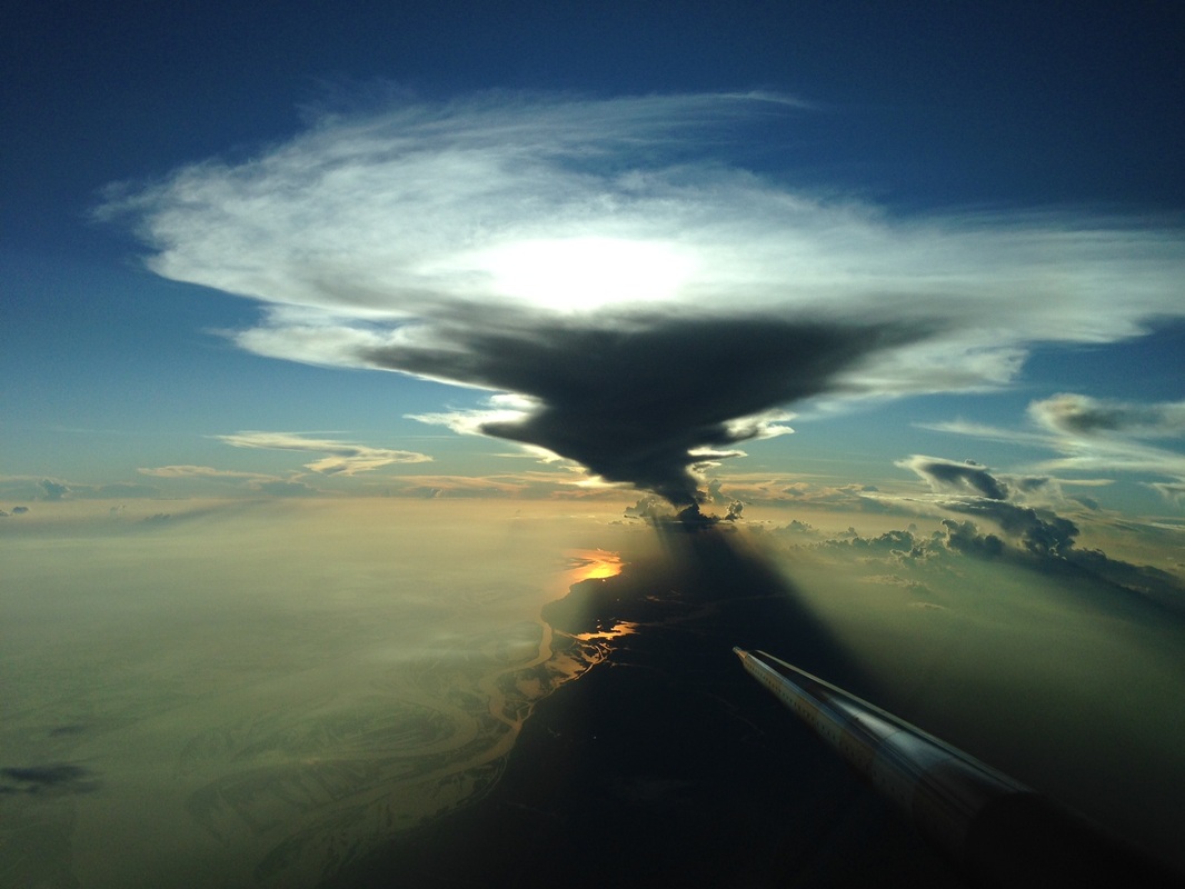
The picture below wins today's "Blogger's Choice Award"! It shows an long outflow from a cumulonimbus cloud, seen from an altitude of about 20,000' when approaching Manaus. Picture credits go to Steffen Gemsa for this one and to Johannes Schneider for the pictures above. At 2200Z (1800 local) HALO landed at the Manaus International Airport.
As promised, there is a second itinerary for this day! Since I was not on HALO, I took the commercial flight on Lufthansa to Rio de Janeiro (11:40 hours long), and then got to spend almost eight hours in beautiful Rio airport waiting for my connection for the 4:15 hour flight to Manaus. I was lucky enough to get a window seat on this flight, and could get a first survey of aerosol and cloud conditions along a stretch from about 23 S to 3 S. I'll show some pictures from this flight below, but keep in mind that pictures of aerosol hazes are, well, a bit hazy!
Starting from Rio, the aerosol burden increased going north, and my first image shows a typical sky at about 19 S. What it also shows is one of the big problems Brazil is facing at this time: the huge reservoir at Tres Marias in Minas Gerais State, like many other reservoirs in Brazil, is almost empty because of a severe drought that has been going on for a long time now. That makes our ACRIDICON-CHUVA research, which addresses the connections between aerosols, clouds, and rain, particularly relevant to this region.
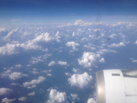
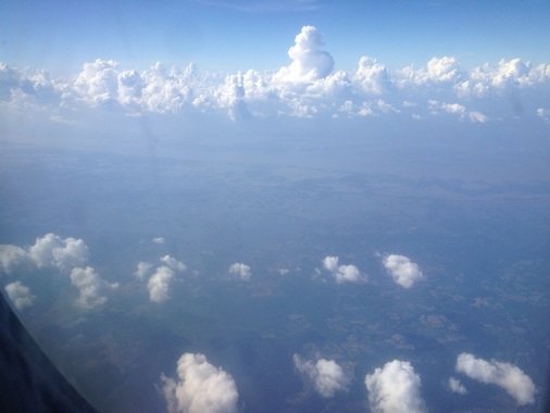
From about 12°S on the air go so hazy that it became difficult to see the ground, and the densest haze was reached at around 10°S.
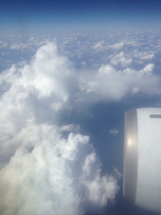
The cumulus convection was more active here as well than in the south, and many clouds were rising to our flight altitude of 36,000’ and even well above us.
On some of them, I could observe the typical wispy plumes of ice particles detraining from the cloud.
On some of them, I could observe the typical wispy plumes of ice particles detraining from the cloud.
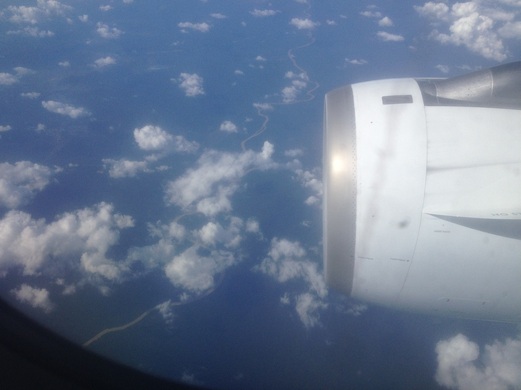
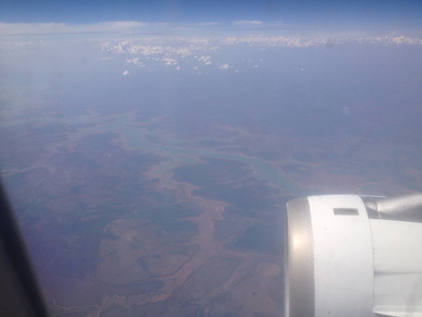
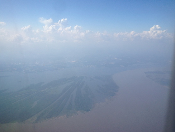
At about 6°S, the air became noticeably cleaner, and one could see small muddy rivers flowing through the rain forest.
| Coming closer to Manaus, there were beautiful cloud scenes, with cumulus clouds of all sizes, from little fair-weather clouds to big cumulonimbi with the characteristic anvil shape that results from ice particles being blown away downwind from the top of the storm cloud. In fact, this reminded me a lot of the first time I had come to the Amazon, about 30 years ago, on a flight south from Venezuela to Manaus, and seen these anvil clouds rising over the Amazon forest. | 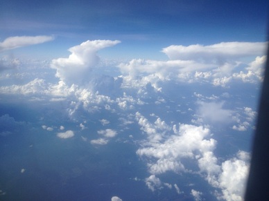 |
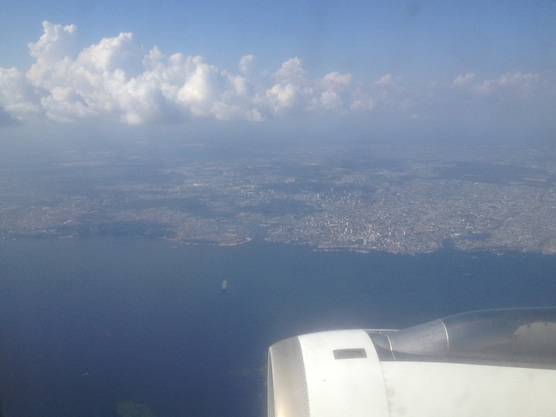
Near Manaus, I had the first view of the Amazon River, which was below quite dense haze, apparently produced by some burning along the shores of the river further downstream to the east. North of the river was a line of cumulus convection.
Then came one of the main touristic features of Manaus, the Meeting of the Waters, where the muddy Solimões River to the South and the coffee-brown Rio Negro flow for a while side by side in the same channel, before they merge to form the actual Amazon River. This being the dry season, the view was a lot less clear than what one can see in the rainy season.
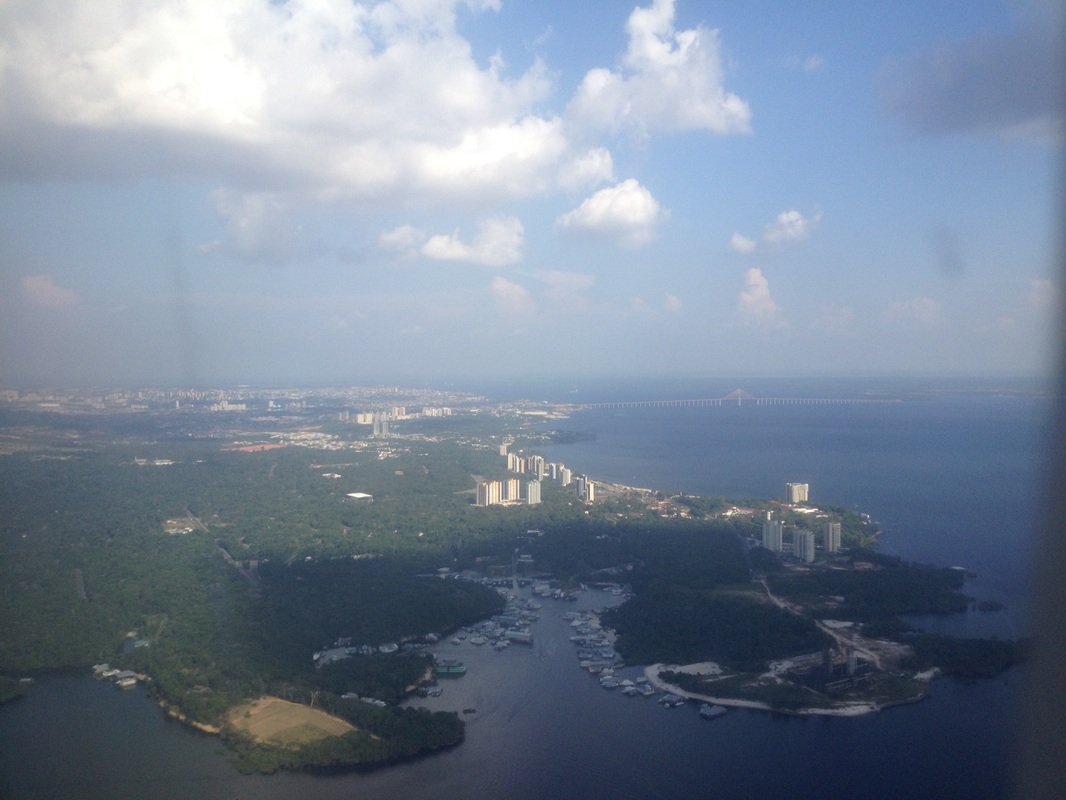
Finally, after a sweep by the city of Manaus, our home away from home for the next month or so, the Hotel Tropical and the Park Suites Hotel tower, located along the Rio Negro came into view just before landing at Manaus airport.
 RSS Feed