So far we have had successful flights for all the five mission types of the campaign, except one which we call the “cloud contrast mission”. This mission was proposed by our Brazilian colleagues who are interested in measuring the convective cloud properties over rain forest and compare it with those collected over deforested areas. Certain differences are expected mainly because of different surface properties (e.g., temperature, latent, and sensible heat fluxes). Therefore, we planned a flight pattern covering different surface types, i.e., extended legs at different altitudes over rainforest, deforested areas and transition zones. As a second mission objective we wanted to compare the airborne data with measurements of the GPM (Global Precipitation Measurement) satellite. Thus, we planned to meet the satellite during the second part of our flight, an exercise that the pilots have already lots of experience with. Last but not least we wanted to fly over the ATTO site, to link the airborne with the tower measurements. As a side product, we wanted to take nice pictures of the tower during the flight.
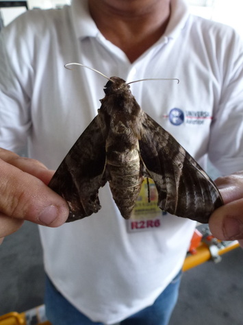
Before taking-off we experienced tropical insects in the hangar, “slightly larger” compared to what we know from Europe (see photo).
Before taking-off we experienced tropical insects in the hangar, “slightly larger” compared to what we know from Europe (see photo).
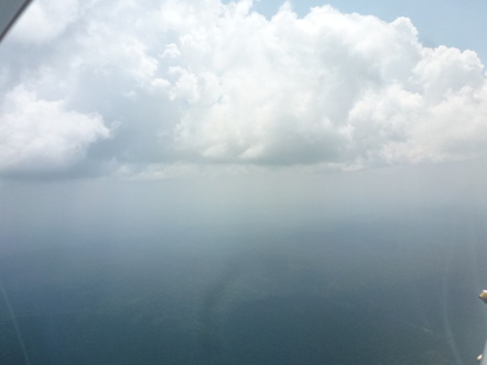
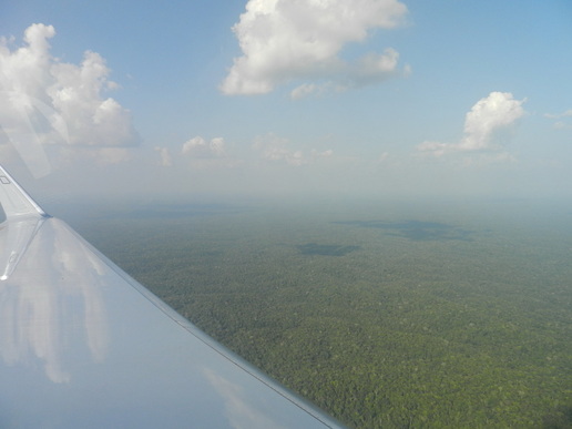
The take-off procedure went very smoothly, as usual. After take-off we climbed and saw that the atmosphere was extremely hazy, in particular below the clouds (see photo). It’s difficult to take an attractive picture of hazy air!
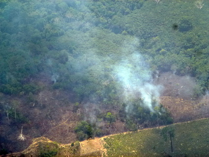
During flight we encountered a lot of fires, especially in the southern part of our track. We are very curious how these fires have influenced the cloud properties; there is exciting analysis work ahead of us. Taking good measurements is only the first step; the fun part starts if you look at the data in more detail after the campaign to make real science out of the measurements. Both parts are equally important for our job.
The picture to the right shows a small deforestation fires that has just about run its course.
The picture to the right shows a small deforestation fires that has just about run its course.
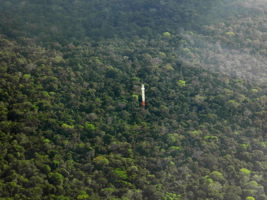
At the end of flight AC17 we took the opportunity to overfly ATTO, make pictures and collect data to link the tower observations with the airborne measurements. This was not as trivial as it sounds because to fly over the tower required entering a military, restricted airspace. Our military observer was actually very helpful in obtaining the permission to fly in this area.
 The Amazon forest in the ATTO area
 We had a good flight and we believe we have now reached most of the scientific objectives of the mission. Detailed analysis is required to quantitatively evaluate the results. Thanks to the whole team, namely the pilots (Stefan and Steffen), our flight technician (Alex), the military observer (Tenente Mendez) who actually was very helpful in maintaining contact with the Portuguese-only-speaking ATC operator at the ground, and the scientists (Tina, Daniel, Tobias, and Christopher)!
(Guest blogger: Manfred Wendisch; photos: Manfred Wendisch, Tina Jurkat)
(Guest blogger: Manfred Wendisch; photos: Manfred Wendisch, Tina Jurkat)
 RSS Feed